


Turkey’s state geology agency has updated the country’s active fault map for the first time in 13 years, increasing the number of mapped active faults from 485 to 700, in a revision officials say will guide earthquake risk planning, infrastructure projects and urban development.
The Directorate General of Mineral Research and Exploration (MTA), a state agency responsible for geological research and mineral exploration, presented the “Turkey Active Fault Map 2026” during an event marking its 91st anniversary, the state-run Anadolu news agency reported Monday.
Vedat Yanık, the agency’s general director, said the new map was prepared after years of field studies and academic research and is supported by a digital database.
“The number of active faults, which was 485 in the 2013 edition, has risen to 700 in this map in light of new data,” Yanık said. “This map and the digital database we prepared will be a basic reference source for earthquake hazard analyses, critical infrastructure investments and national damage reduction policies.”
The figure does not mean 215 new faults have appeared in Turkey but rather that scientists have added detail to the map by using new field data, separating some fault systems into smaller segments and defining fault lines that were not mapped in the previous version.
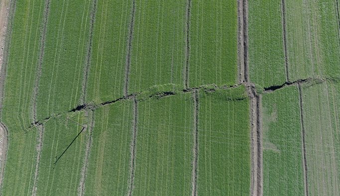
A fault is a break in the Earth’s crust where blocks of rock move against each other. An active fault is one that shows evidence of movement in the geological past and is treated by scientists as a possible source of future earthquakes.
That matters in Turkey, where earthquakes are not rare events but a national safety issue affecting housing, transportation, energy networks, dams, schools and hospitals.
The map shows where known active fault lines are, helping authorities assess where shaking or surface rupture should be taken into account before buildings, roads, pipelines and other projects are approved.
Turkey sits on the Anatolian plate, which is squeezed by larger plates and crossed by several major fault systems. The North Anatolian Fault runs across northern Turkey toward the Marmara region, while the East Anatolian Fault cuts across the southeast.
The southeast remains under scrutiny after the February 6, 2023, earthquakes centered near Kahramanmaraş killed more than 53,000 people in Turkey and injured more than 107,000, according to official figures. The quakes, measured by the US Geological Survey at magnitudes 7.8 and 7.5, exposed failures in building quality, inspection and emergency planning.
The new map gives more detail on the main active belts, including the North Anatolian Fault Zone, the East Anatolian Fault Zone and fault systems in western Turkey and the Aegean region.
The Marmara region, home to İstanbul and much of Turkey’s economy, remains one of the areas watched by scientists because of the western branch of the North Anatolian Fault. The Aegean region, including İzmir, Manisa, Aydın, Denizli, Muğla and Balıkesir, contains many shorter fault segments.
Eastern Anatolia includes fault systems around Kahramanmaraş, Malatya, Elazığ, Bingöl, the Lake Van area and the Erzurum-Kars line.
Yanık said Turkey’s position in the Alp Himalayan mountain belt makes updated data on active tectonic structures a matter of national security, development and disaster risk reduction.
Scientists and professional chambers in Turkey have often warned that earthquake losses are driven not only by geology but also by poor planning, unsafe buildings and weak enforcement of construction rules.